Garmin Activity: https://connect.garmin.com/modern/activity/617658258
72km, 3h23, elevation 947m
A friend of mine told me that there was a website with some Garmin .gpx data routes for central Taiwan. I checked it out and, although there was not a lot of useful stuff there, they did have one short track of the Fengyuan area (about 27km). I uploaded this .gpx file on my Garmin and went to check it out. From Shalu I first navigated there, did the track and then went back home.
The first part, from Shalu to Fengyuan was nothing new. I had done that one several times, but this time I was following the route proposed by my Garimn, which turned out to be somewhat different.

Early in the morning, at the Taichung Metropolitan Garden in Shalu

One of those lanes I pass by almost on a daily basis, really love the 17% climb up here, it's just great!

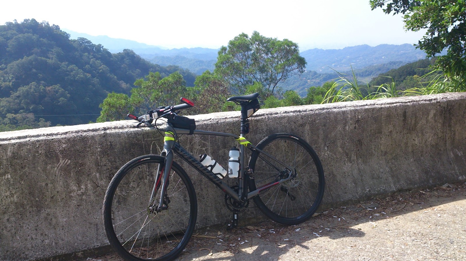
Somewhere in Shengang, my GPS sent me through an unknown road. The view was nice so I took a picture of my new bike with the rice field in the background.

Fengyuan Boulevard (Fengyuan Dadao, wu duan), section five. My GPS sent me left, for Taichung-88. Later I would learn that that climb frmo Shuijing to Xinshe is called "Wanli Changcheng". It would become a frequent traveled for me during later rides.

The first few miles were not that steep, a modest gradient showing me uphill.

Beautiful, desolate Fengyuan in the early morning. Some cyclists around, not too many vehicles.

Then I went through a tunnel with some cool wall paintings

After a few km, the road took a turn to the right, which was where the climb actually started. The first two kilometers often had 10% and more gradients, even peaking at 15% somewhere.

Welcome to Wanli Changcheng, the way up to Xinshe!

Yes, you are right in pointing out that I was not wearing a helmet today haha. Not cool, I know!

Since it was only a very small trip, I decided to take my flatbar. And I was dressed really casual. Just a chill ride that's all :-)

After the first pinchy section, the road became a little less steep. After a few miles there were another few 12-13% sections, mostly in the turns, but nothing impossible. And I say that from a heavy alloy bike perspective!

Riding my flatbar road bike is always fun. See the Garmin track I am following? I got it from a Taiwanese website. It was fun to discover some cool cycling lanes outside the crowded city center.

Pushing my alloy baby uphill!

Then there is asomewhat more flat section. I stopped for some pictures because the view was very lovely!

Good job Bartman, good job!

These are the hills that lay behind Fengyuan, near Xinshe
Nice views right?


Then there was a last section going uphill. This was the first indication that I was on the right way, Taichung-88. Luckily there was no need to doubt with my preloaded Garmin track.

There is one more steeper climb of only a few hundred meters before making it to the top, which is called Shuiyuan Li (Water Source Village in Chinese)

During this ride, I followed my Garmin track like an idiot, but from studying the map at home I learned that I rode Taichung-88 to Xinshe, connected to Taichung-93 which runs from South to North. I went north, to Kunshan village. Then, in a small lane I was sent left. Right after entering there is a very, very steep descent of some 22%. I was very happy with my disc brakes at this time. Later my friends told me that this lane was called Nankeng Xiang (Southern Hill Lane). The official route denomination is Taichung-87.

After the incredibly steep descent, I found a road that was still in construction. Just sand and some rocks. Luckily I wasn't riding my race bike and I was covered by my 32mm Nimbus tires.

I just came down from here. This road is called Nankeng Xiang (Southern slope lane). There are several small lanes like this in the Fengyuan area and there is also a Beikeng Xiang (North slope lane) and Zhongkeng xiang (central slope lane). There is no eastern or western slope lane though.

After that creepy descent, most of it is level or descending very plainly (1-2%)


After a few miles you get to see this sign: Taichung city's Fengyuan area. This Taichung-87 leads back to the Zhongzheng park and the Fengyuan area.

Then I wrapped it up and went back home via Shengang and Daya. Just a small ride, but I did around 1000m of elevation gain and I explored Fengyuan quite nicely.


In Shalu I took another climb for Metropolitan Garden. This cute little sign made out of wood indicates the road to Shalu. Just fantastic isn't it?
No comments:
Post a Comment