Activity 1/2: https://connect.garmin.com/modern/activity/643176130
Activity 2/2: https://connect.garmin.com/modern/activity/643176146
(I accidentally ended my activity so had to create a second one)217km, 10h22, elevation 3650m
(I accidentally ended my activity so had to create a second one)217km, 10h22, elevation 3650m
When I set out today, I did not have a specific goal. I just cycled east to Fengyuan like I often do. I climbed Wanli Changcheng to Xinshe and descended to Dongshi bridge. That's where I decided I would climb all the way up to the 50km mark of Daxueshan, the Big Snow Mountain. Always a good ride, and so peaceful and tranquil on ordinary week days. The weather was also good for it, not too hot, no rainy clouds above me.

The first few miles of Route Zhongzhuan-1, the road to Daxueshan


Good morning Dongshi and Heping, ready to host this cyclophile today?

This picture is taken at the 8km point. The background in this picture is where I came from. The first few miles of this section present some nice gradients and the altitude gain is a few hundred meters.

Got my motor pumpin', enough to take out my wind vest

When I saw this writing, which says in Chinese: I don't oppose a cycling race on Daxueshan, I thought about what my Fengyuan friends said: There used to be a race here, but it was not organized this year. A few hundred meters earlier I saw a writing "I do oppose a race on Daxueshan"

After some good 13km of climbing, I reached the boundary between Taichung county's Dongshi and Heping areas.

A very enjoyable ride was in its course

Welcome to Heping township in Taichung county. According to the numbers, the largest township in Taiwan with the least amount of inhabitants. Check your map and you will see how gigantic Heping really is.

After 15km you will see this cross section. Going straight, somewhat leftish; is the road for Daxueshan, the main road. Been there, done that. Today I would first check out what was on the right. Only two km according to the sign, so nothing groundbreaking
Inside was a nice descent and then this area, not many people come here obviously. It was as beautiful as it was tranquil and peaceful

I asked those two tourists to take my picture


I kept following this direction and I saw one woman on a motorcycle, who told me there was nothing further down the road. I did some sightseeing and went back, after all, there was still 35km of ascent waiting for me.


Beautiful though!

The little lanes that lead to nowhere

Getting back to the main road to Daxueshan's peak

At the 15,6km mark, you will see this little path. This path is called Chuandong Daolu (Chinese for: the road that crosses through "Dong", with Dong referring to this area's name). It is basically a connection between Daxueshan 15km and Taichung-47's 10km mark. I have cycled that one in February 2015 and I will elaborate on that in another post. Let's just add that it was no road bike section, so I was clear to tick that off the to-do list for today.

Between 16 and 26km is just one long climb. I had done it quite a few times and today I did not stop for pictures in this section. It is mostly forests, mountain paths and some occasional birds flying over. At the 26,5km mark, you will see this Hengling Tunnel, which is kinda scary. Just make sure you turn on your light and ride in the middle, so no car could pass you by.

There is always light at the end of the tunnel, even in Daxueshan

Made it safely to the other side, also meant I completed more than 50% of today's climb.

The beauty of Taiwan's Fall. I could just wile away on this mountain for days and weeks.

Just me, this mountain and those beautiful autumn leaves. It was a good day to be outside.


The 32km bridge, my absolute favorite spot.


Current location? Right in the middle of the central mountain range, far away from the Western plains of Formosa

The few miles from 30 to 35km are rather flat. Then there is a checkpoint where you need to pay a 100 NT to get in; And then we enter the enticing Daxueshan national park, which is basically another 15km of mountainous work;

The 40km mark, 10km remaining in this beautiful autumn scenery.


Daxueshan is at its most beautiful in this season, I must say


A mini detour at 41km's Anli Work station


Being accompanied by my wonderful SW Roubaix. For today, I equipped it with a rear 30mm and a front 28mm tyre; Will fit in just nicely in this frameset. That way I will have all the grip I need when going downhill.

Ain't she a beauty! Only bought it a few months agao, but already got 7k on there
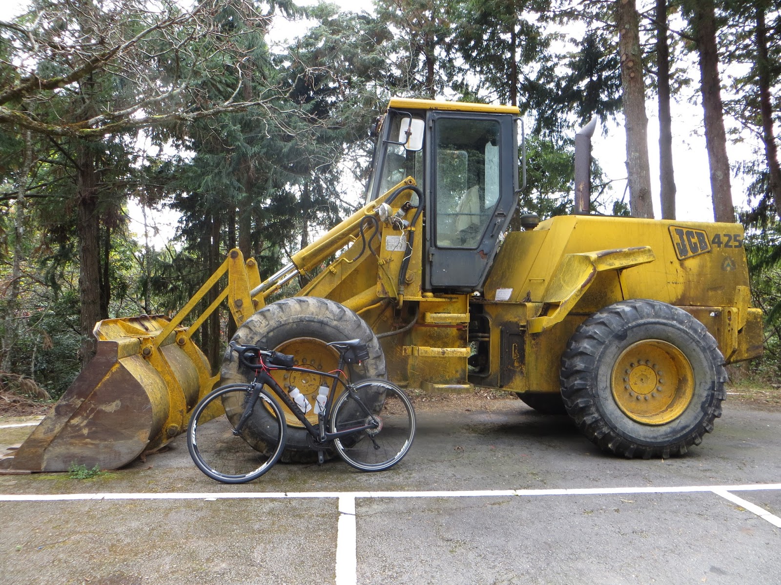
Something my two brothers will appreciate, a construction vehicle, a giant bulldozer

Indications for safe usage of the trails

Watch out for bears! Well I'm a beast myself I'd say

The 50km spot came really fast, and I wanted to check those two spots I hadn't visited yet, the Tianchi Heavenly Pond and the Shenmu sacred tree.

At the 48km watching deck, where a map explains the different mountains in this panorama. Always a nice view.

Be-au-ti-ful!

I met an elder couple here and we started to chat. They took this picture for me.


Bartman high in the sky at 2500 elevation

The 49km mark, back in early September, on my first journey here, I thought this was the end mark. I did not find a 50km mark sign. Today I did.


Mission accomplished, the 50km mark. Good job! Now let's take a rest and enjoy the fruits of my hard work.

At first I thought this was the only way to go, until some people told me I could cycle around it. That's what I did, as these cycling shoes were not a joy to be walking in.

In Chinese "Tianchi", in English: Heavenly Pond. Normally it is way larger than this, but is has been dry for several months and this has its impact.

This has the be the highest peak of the entire mountain. Coming up here was almost another 50 meters of elevation. Lot's of tourists here, eager to learn more about this cycling foreigner, so i took my chance and eternalized this moment with a snapshot. One minor setback: I accidentally ended my Garmin Activity, but solved it with directly starting a new one. So there is two Garmin routes for today's trip. The only time ever this has happened to me.
Then I went back down again, did not stop for pictures on my way down. I will only add that these 28/30mm tires provided me with a lot of grip and it was a joy descending like this.
When I arrived in Dongshi, I did not go back to Fengyuan straight away. I cycled Hwy 8 until the 13km mark, went over the bridge, and cycled via Taichung-95-1 back into Xinshe. I did this for more mileage (I wanted 200km today) and more elevation gain (I wanted 3000)

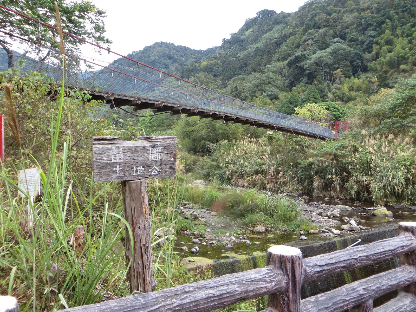
A picture of the suspension bridge at the 13km mark of Hwy 8

If I was really crazy, I could have pursued my way to Guguan. But I though tthat this was nice already.


I kept following Taichung-95 until I made it to Zhongxingling again. It was already getting dark. I told my GPS to navigate me back to Fengyuan, but it sent me through a grand tour de Xinshe. I even descended via Nankeng, which is dangerously steep (minus 24%). As it was dark and raining; I decided to walk that section.


When I finally made it to Fengyuan, it was already past six in the evening. It turned out to be a late one today. But I did accomplish my three criteria: more than 200km, more than eight hours, more than 3000m elevation. Great job!
No comments:
Post a Comment