Garmin Activity. https://connect.garmin.com/modern/activity/634794441
153km, 7h02, elevation 2310m
A few weeks ago, the Happy Cycling Club and me had visited a place I did not know about yet. This place was called "Xiangbi tribe". We cycled to Xiangbi elementary school and back again. A road I had not yet ridden before. They told me that from that elementary school there was a road that connected to Dahu in Miaoli. I was so intrigued by this, that I just had to go check that one out.
From that ride, I had saved the location of Xiangbi Elementary in my Garmin GPS, so now I could just tell my GPS to navigate me to that spot. So on an early morning, with the threat of rain, I set out from Shalu and cycled to Fengyuan. My GPS guided me through Taichung-90, aka Gonglaoping, a road I did not know at the time. Neither did I know that this would be the stage of a cycling race, which I would finish as nr. 1 and winn a Novatec R1 wheelset haha. Today, it was just meeting this ride.

The road to Gonglaoping

A view over Shigang and Fengyuan

Grey skies and very low temperatures was what I was getting today

Taichung-90, which will lead to Shigang


I did not know it at the time, but lots of memories were to be had here...

From Shigang, I connected to a cycling path that would lead to Dongshi. We rode this one last time too

In Dongshi, my GPS sent me to Taichung-47, which was the route to Xiangbi. The first 10km went uphill, then down again and then a variety of short, quick climbs and descents. After 13km, I reached this spot with a nice view over the Dajia river.

When we last came here with the cycling club, we stopped for pictures here.

From that point it's another 15km to Xiangbi, which goes up and down. I stopped at the little shop right before the tribe for some reinforcements and then I got ready for action.

Zhongxiao Road, in just 12km I should connect to Miaoli-61, which connects to Dahu city center

Dajia river bed, at the very eastern part of Taichung county, there is no more water in this river, it's completely dried up

It was rather chilly, so I wore my wind stopper jacket.
Now I was going past the school and into the mountains

At this intersection I was going straight up, and in mean as straight as straight up spokes in a wheelset; This road was very steep, often going to 19%, sometimes 15% but never less. It was an ordeal just keeping my bike moving. The underground wasn't that good for a road bike either, a few times I lost grip and I was sent walking. With my road bike clicking shoes it sometimes was impossible to click back in again. I would need to change strategies for this one when I come back


I had only climbed 1.6km, but I was already tired, this road was going up like a rocket

No trouble in taking out that wind stopper jacket, wouldn't be cold in this section

I took a quick picture with my GPS, 14%, but mostly it was so steep that my hands were not free

After some six to seven km, there was a somewhat more doable section. I took a rest here and checked out the sceneries. It was a beautiful sight though. Really far away from society.

There were wild dogs chasing me at this point, luckily they got scared of my lion-like roaring

Clouds in the mountain range

It looked as if the road was changing into a descent. With the slippery conditions, I would have to be careful!


Just my luck, road construction works, and that was just plain mud in front of me

The problem was descending in this slippery shit. I had no other choice but to take it out on my wheelset.

Good thing I was riding beefy 30mm tires, it did change a lot for the better about my grip

Crazy gradients down, 14% was nothing compared to the -19% that got me sweating like a scared infant

That dangerously crazy descent continued for quite some km. Honestly, there was a section were I just walked. I was not gonna crash my beautiful frame on this ride. After a few KM, which took me almost an hour (!) I reached a somewhat more level spot. It was an aboriginal village

Still safe and sound, that's what matters most

The weather was not perfect and I did not take my camera for safety precautions, all I can present to you are these mobile phone pictures. This picture above indicates Miaoli-61, which would lead back to Dahu in ten km.

An Atayah warrior, called Yongshi (the brave one) in Chinese

Honestly, this place is fantastic! Almost no traffic in here

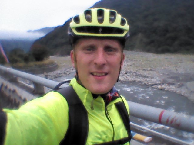
Nothing fake about that smile, I had been through some bad shit, but I made it out alive!

After today, I could also be referred to as Yongshi (the brave one). Braveheart sounds better haha
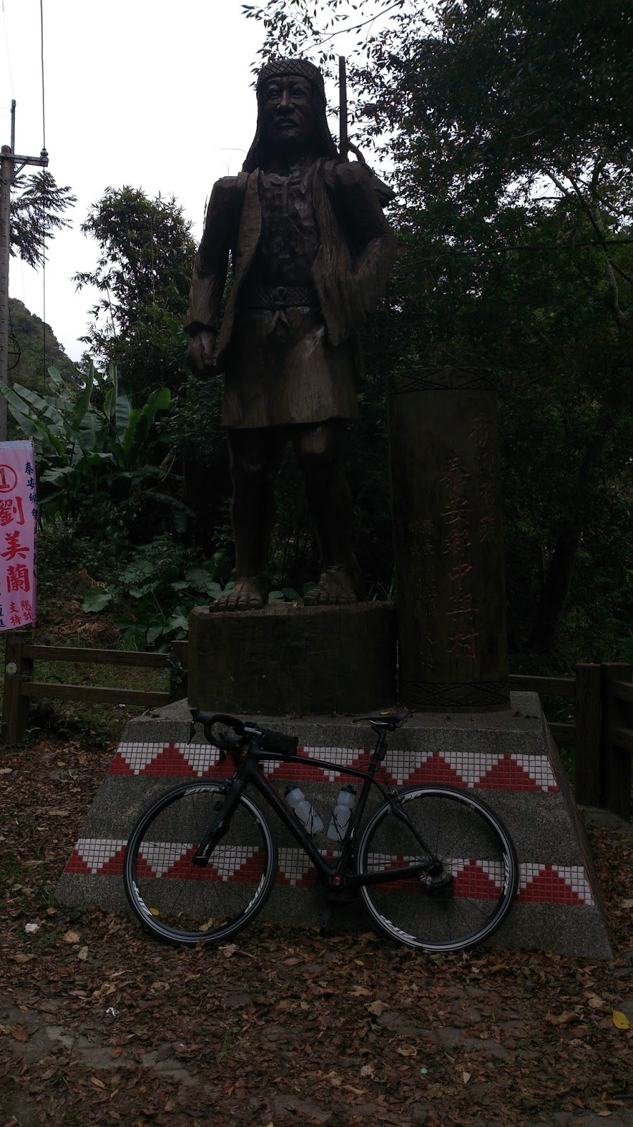
Giant aboriginal creature

From a different angle I got a better light on the picture

The strawberry plains of Dahu! I had officially passed through the mountains of eastern Taichung to Miaoli. Excellent work!

I lost a lot of time walking sections downhill, that's why I decided to start heading home. But there was still time for a little detour through Miaoli-55, a nice way around Hwy 3; Only downside: more climbing

But we survived that section as well. I connected to Zhuolan, where I stopped for a snack and then I took this cycling path back to Fengyuan, where I stopped for tea and talks

When I got back to Shalu, it was really late. This picture is the Wing of Shalu, with Taiwan boulevard at my left and Qingshui to my right. Straight ahead would be Shalu city center.

I had been outside all day, did not accomplish an extreme amount of mileage, but I did priceless discoveries! Today would definitely not be the last time I would visit Xiangbi and Dahu.

No comments:
Post a Comment