Garmin Activity 1: https://connect.garmin.com/modern/activity/791758519
42km, 2h17, elevation 1162m
I combined many of the steep hills of Shalu together to a single ride today. It was tough, in only 40km I climbed 1000m. Those are KOM statistics. And all of that climbing is super steep as well. It sounds like a nice morning ride for exercising. You can check my Garmin map to see how I did it, but in a brief summary:
- I climbed up Bangwen road and descended along the small mountain path
- I climbed up again via Dongjinlu and descended via Houshan road
- I climbed up via Hongzhuxiang and descended via the other small road there
- Then I entered the dead end alley next to Taichung-67 and then one of the tiny roads back up to metropolitan garden.,
So a lot of climbing this morning! And good I had my disc brakes to enjoy during the descents.

During this KOM ride, I still did some exploring. I discovered that there was another steep ally right next to Taichung-67. Unfortunately it was a dead end, but I did get a nice view over Shalu. That temple n this picture is a crematorium,

I stopped for a snapshot of the Metropolitan Garden (Taichung-75)

One of my first discoveries in Central Taiwan. Back in August 2014, I was nearly dead from that climb.

1200 m elevation in 37km, crazy figures!

I sought a moment of rest within the metropolitan garden. The tranquility felt like a Buddhist monastery

Bicycle route within the Metropolitan Garden. I made a small video report here

It is not often that I come here, although this place is nice
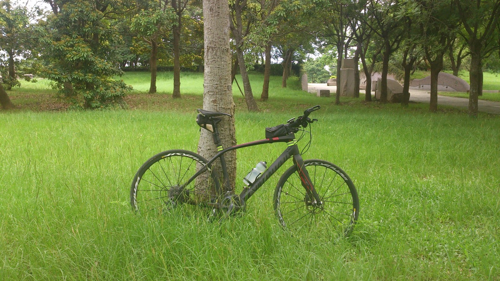
My workout buddy, Sirrus! These wheels make a difference in climbing

I succeeded in getting my bike to stand up. A position for a champion.

Enjoying life right here in my block, less than 1500 m from my house. That's the shit right there!

God I love this bike! It can do just everything!

This downhill section is pretty steep, but no worries with these disc brakes.

I first went back home and had a shower. Then there was a second activity of the day...
Garmin Activity 2: https://connect.garmin.com/modern/activity/835577567
50km, 2h17, elevation 430m
Somewhere after 12, I left Shalu and went to Fengyuan. I sat there a few hours and then I went to Taichung city, via the route I am used to taking: Chongde road. When I was back home, I calculated that I had cycled almost 100km today, but with more than 1600m elevation gan
No comments:
Post a Comment