Garmin Activity: https://connect.garmin.com/modern/activity/706358483
131km, 6h05, elevation 1842m
Wednesday, February 25, 2015, another day with classes planned in the afternoon until the evening. A wonderful opportunity to do some cycling in the early morning. I got up as soon as I saw daylight, had my breakfast and hit the road. I first went up Taiwan Boulevard, then I took the 136 through Taichung, with Taiping planned as my next move.

If you connect to route 136 from Taiwan Boulevard, you will face a T-split intersection. The weather was foggy and sight was limited. Initially cycling prospects did not look good.

On a normal day you can look all the way to the end of this hill. Today was a different story. I thought it might rain later on but that was fine.
I mad my way through the maze of Taichung city. Most of ride was taken care of by Xiangshan road. I stopped at the Hi-Life for some snacks and then I entered phase two of my ride. For today I had the following planned: Take Taichung-99 and climb until the intersection with Taichung-100. Then I would continue until the intersection with Ziqiang road and take that climb all the way to Xinshe. If this explanation confuses you, please open my Garmin map. These are all small and deserted mountain paths on the eastern edge of Taichung, with almost no traffic. For someone looking for a good ride, they truly are DA SHIT right there.

Climbing along Taichung-99, the so called Beitian road. I had ridden it before, but lately I was doing some serious map research in these areas and my rides were getting wilder and wilder. Today would be a classroom example of that.

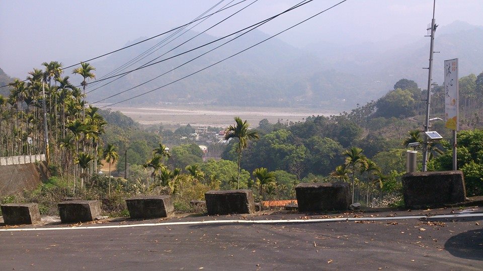
Dressed casually, riding my city-orientated flatbar, going for challenging experiences!

Notice the little brown sign with white characters on the right, above my bike. It is the Chinese indication for Beitian road. I was nearing the intersetion with Taichung-100, which is called Maopu road. All of this knowledge is fruit of my investing and research here whenever I have a spare moment.

Later I turned right to enter Taichung-100. This road offered me a good steep climb of a few km and then it went down again. I was riding over a small hill here. It is interesting to see that there are also many side roads along this tiny little section. Most of them are private properties and therefore should be avoided, but some of them might be sweet secrets that could embellish future rides. I would be a fool not to look into this.

None of these sections are long, but the accumulation of them does make for a pro-style ride. I had only just come down from Maopu road and I saw this pack of signs in front of me. The only relevant sign of these was the upper one: Ziqiang road/ This is a very long and steep climb that eventually will lead to Xinshe. But the way there is though if you haven't been working out...

I did not take many pictures here because I wanted to finish this climb in one piece. I think it was about five km of continues climbing, gradients varying from 8% to 14%. I did stop for one snapshot here, with these hills and mountains in the background. This flatbar was providing me with lovely rides!

I made it to the top of that climb. The signs on the left indicate Xinshe and Guguan. From here it is mostly downhill. A perfect terrain for probing disc brake performance.

I made it downhill safe and Xinshe was near. However, I know from my first ride here that there is a cooler way to go to Xinshe, which involves one extra climb. For that, I had to go straight ahead and not left like this sign.
That climb was only one kilometer, but again, it had 14% in there. The view on the top was extremely beautiful. I could see right across the Dajia river and Hwy 8 was lying there on the other side. I am beginning to understand the topography of Central Taiwan better and better and I am liking it more everyday. Soon I will have the authority of leading tourist groups here haha.

Again, that descent from the top to Taichung-95 is super steep. I think it is more than 15%. I felt great riding this disc brake monster. It made such a big difference for me. This picture was taken at the Yong'an bridge and connected me to Hwy 8. From there, I was going left.

Some wall art. It says in Chinese: The purple homeland, romantic Zhonghe. I did see a lot of stuff in purple on rides through here. Don't know what the deal with that is, but it is nice.
Back at Hwy 8, I was going in the direction of Dongshi. However, I had one more thing planned for this ride. I had done some map research at home and I had found there is a little lane called Taichung-46, which runs like a circle around a hill. I wanted to check it out. It was located at the 9km mark of Hwy 8, some 4km from where I entered the highway. You wouldn't have noticed this little street if you didn't know it was there. Luckily I did, so I went for it. Here, I started using my Garmin Forerunner watch as a GPS. Unfortunately, there was not a lot of power in there, but I did manage to track my whereabouts at Taichung-46.

I could feel this thing elevating right from the start. First it was gentle, with some 2-3%, but then after this sign it started to get really steep, and I mean more than 19% steep. I had to use my smallest cog and I had to climb out of the saddle in order to be able to continue cycling. It was also very, very hot, somewhere near 40 degrees Celcius. I could feel my heart pumping and I loved it. Later, the elevation would get less tough on me, but the climb did continue for several km. I think it was about 8km of climbing here, which was more than the previous mountain passes combined. My morning ride was turning into a killer episode of Bicycle Bartman. I saw a little sign referring to this road as huanshandao, Chinese for: Road that runs around the mountain. No shit! Good name for it!

This road was really tranquil. Solitude was all that surrounded me. There were a few houses but apart from those, it was just me and mother nature. Amazing views. I stopped that the 5km mark because I noticed something special had happened: I had done more than 3000km on this bike I bought only six weeks ago. That called for a celebration!

3000 already, at this pace, 10,000 km will happen soon enough!
I finished my climb of Taichung-46 and I went back to Hwy 8. I stopped at that 7-11 because I was thirsty. This morning ride started to look like a real long all day ride by now. The power in my Garmin watch was gone, but that was not a problem. I returned to Fengyuan via the Dongfeng cycling lane. I noticed I was getting good mileage today.

A picture of the Dongfeng cycling lane, somewhere around Shigang. In the weekends, these lanes are super crowded but on an ordinary Wednesday morning, they are perfectly fine. I returned to Fengyuan where I had tea with my friends. Later in the afternoon I went to the school for my classes. I had classed until 10pm. When I came home, I had more than 130km on my bike computer. For a working day, that is an insane amount!
No comments:
Post a Comment