Garmin Activity: https://connect.garmin.com/modern/activity/906692999
234km, 8h47, elevation 2136m
I had spent the entire weekend in Yilan, but now it was time to move on. I wanted to finish my trip of the island before my flight. I woke up early and Xi Zihuai accompanied me for breakfast nearby his place.

The spectacular view at Xueshan from Toucheng

My bike was ready for the next stage of Tour de Taiwan

Some pictures with Xu Zihuai and his parents


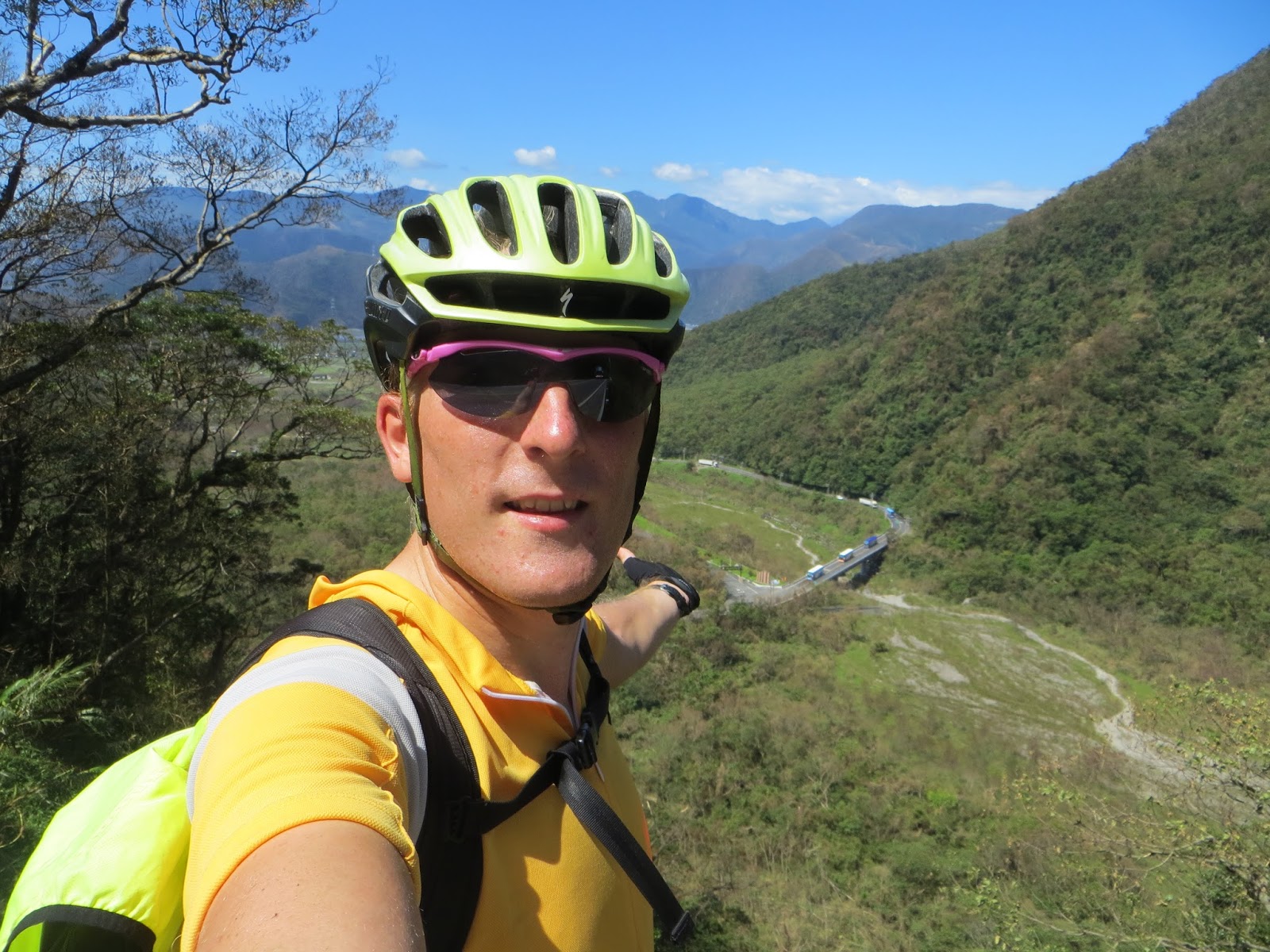
He also took some nice snapshots of me here

Very cool setting
We had a breakfast in his street, the Zhonglun village. After that, he would guide me to the section of Hwy 2 that would run to Su'ao. He navigated me through some small roads, running next to a channel etc. At last we made it to Hwy 2.

This is where we said goodbye. I thanked him for everything and promised I would be careful

From here it would just be me and my flatbar

The view of Hwy 2 in the early morning. I was heading south on the eastern coast.

The weather was awesome

Ready for a rematch of Suhua road

I stopped at this 711 for refreshments and I double checked that I was going the right way to Su'ao

I came by a small town called Saima, race horse. I had to take a picture of that to show my mom

I was already more than 20km from Toucheng. Su'ao was not far anymore


Eventually I was in Su'ao and I recognized everything from 2013. Left was the entrance to the legendary Su-Hua road. between Su'ao and Hualien. It is known as the most dangerous road of Taiwan because it is located on the mountain, directly next to the sea. There have been people who crashed their car in the ocean and died. I would be riding on the right side, closer to the mountain, so for me that should be fine. Coming from the other direction would be more dangerous.

As soon as I entered Su-hua road, I could feel elevation started to kick in.

One of the many bridges along Suhua road.

Hwy 9, 105km mark. Hwy 9 starts in Taipei, runs over Beiyi road, Yilan, Su'ao over Suhua road on to Hualien. I remember from Hualien rides that in Hualien the 189km mark is waiting for me. So in other word, there would be a good 80km of Su-Hua road ahead of me.


It was my second ever ride along Suhua road. I had done it before in August 2013. I remembered several sections, but then again I forgot about others.

That 23mm tire better not flat out here

The first few km of Su-Hua road were a fairly steep ascent to 250-300m. Then there was a descent, back to almost zero.

See how the road is located on the most outer edge of the mountain. If you hit that railing, you are history

The Great Ocean, the Pacific.

I stopped here for some pictures because the road was a little wider. Some sections are indeed wider and suitable for tourism, others are narrow and should only be used for passage.

It is known as the most dangerous road, but for those who actually ride it, it is a stunningly beautiful road as well.

A memorial mark about the construction of Su-hua road. I saw that they are also building an expressway here. That should be finished in 2017.

So close to the coast but experiencing a genuine mountain path

Obviously some selfies

After the first ascent and descent, I arrived in Dong'ao village. It is a small village with a station and a Family Mart. Just like in 2013, I stopped at this 711 for a small break.

Dong'ao train station. Lots of people take the train from Su'ao to Hualien, because they are afraid of this dangerous road.

A dark and narrow tunnel was waiting for me, time to switch on my lights

Here I had a clear view of my descent. I would be riding on that road down there in just a few moments. I began seeing more traffic here, especially tour buses.

The entire profile of Su-hua is basically ascent and descent, it never reaches a high elevation. The highest point might be somewhere around 370meters
Su-hua brought to you by Bartman


See those tour buses? There were many of them

I cycled through a small village that was inhabited by aboriginals, Atayah tribe to be precise

I like aboriginal villages


After Dong'ao, it was now Nan'ao. A lot of names with that character Ao: Su'ao, Dong' ao, Nan'ao

After exiting Nan'ao village I saw a sign of which I remembered and recognized all the names: Heping is the name of an area inside this Suhua road. Xincheng speaks for itself, it was a core location of my Wuling rides. Of course Hualien was the biggest name on the sign. Only 52km to Xincheng and then Su-hua would be over again. Less than three hours I would say.

The road was blocked for a few minutes. I think there were some construction works in course. I saw a few motorbikes riding together. Maybe they were travelling around the island together.

Happy to be riding this Su-Hua road again. It is such a cool experience


This was a nice picture of my precious bike, with the big Pacific behind it


From this picture it is clear how dangerous this road can be. If you would hit that barrier at some speed, you will definitely land into the ocean. Or even worse: collapse on the rocks that may be down there... Scary if you think about it. Riding it at daylight and keeping your speed down is essential for motorvehicles.

However, the Pacific was stunning as always. It had not lost one bit of its charm in those two years.

It's at moments like these that I actually realize how much I enjoy riding a bicycle. I used to be a guy that could spend days inside. How the bike has changed me!


The views and the feeling were so amazing that I took more pictures

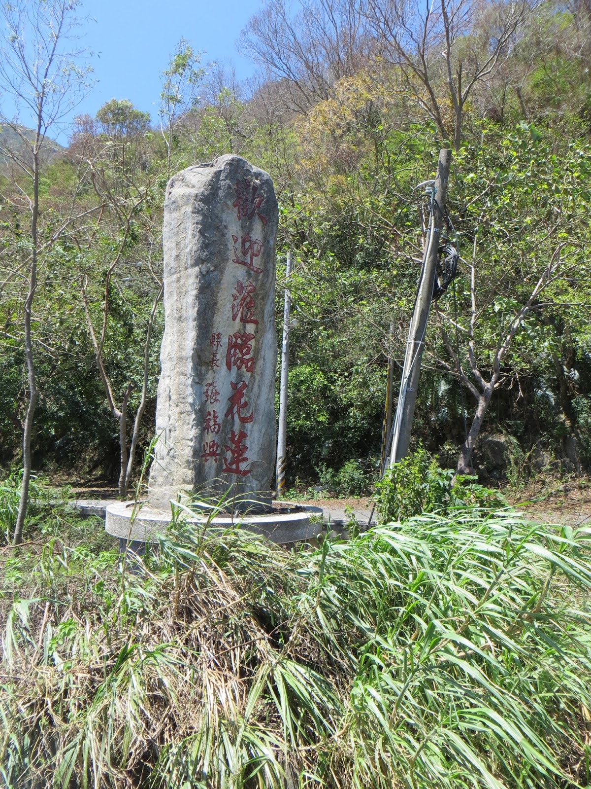
This was the official border between Yilan county and Hualien county. There was a small village called Aohua at the right of this picture. Again, the character Ao. Xiulin was the same township as Xincheng, so that meant I was getting close to the exit of Suhua road.

See that little sign on the bridge? 155km? It meant that I would have some 30km more on Suhua road, or 66% completed.


This was a wide section, good for digesting traffic. Somewhat after taking this picture I saw a guy with a flat tire. Unfortunately he was riding an MTB so I could not help in. He did not have a spare tire and sure did not have one for him. There was a KYMCO scooter repair shop there, maybe they were able to help out.


Welcome to Hualien county

There were some quads here, had to show these to my brother.


This was the Heping area, there was a big gas station, there were a few tunnel and I saw construction works for the expressway. Once that expressway comes, a lot of traffic will not be using Suhua anymore, which is better for cyclists and local drivers.

I like this picture, it offers a very clear view of how dangerous this road is. That road is almost non existent in this mountain. If it rains or there has been a typhoon, there can be mud streams or falling rocks. On top of that, it goes directly into the ocean after that fence.

50 shades of blue, blue as far as the eye can reach

Up to now the journey has been very enjoyable


Taroko National Park appeared in front of me, Xincheng was close...


This looks like paradise, too bad I cannot stay...

A whole in the mountain, a narrow stretch

This area was called Chenggong

All of the sudden I arrived at this spot and I knew right away where I was: near Taroko bridge in Xincheng. Su-Hua road was already over. From this location, it was around 200km to Taitung. That would be too much for today, but I did not feel like ending my journey in Hualien. Actually I did that in 2013. I arrived around noon in Hualien while I could have continued my journey. But that was mostly because I did not have the gut to spend the night in smaller areas back then. Hualien and Taitung were the only places I considered for spending the night.

The Taroko National Park. Honestly, I have come here a lot of times over the last few months.

Taroko bridge

In Xincheng I decided to continue to Hualien right away, not wasting too much time. I did look at my map to make a good estimation of what I could do next for the rest of the day.

Well, I HAD to have a picture at this spot. This is where I came in the middle of the night when a new Wuling ride was ahead of me, or during my last trip, when I came all the way from Taitung and it was raining here. The point I am trying to make here is that this spot is mythical to me.

Hwy 9 from whence I just came behind me. Usually the time of being here would be different and so would be the riding direction

A guy on a scooter stopped and asked if he could take my picture. That was very kind of him. He took a few shots. Up to you to decide which one looks best.


Then I pursued my journey south. I checked the map before and I had come to the following conclusion: When I cycled around the island in 2013, I used Hwy 9 for the section Hualien - Taitung. When I cycled around Taiwan in July, I had checked out Hwy 11 along the coast. So my conclusion was that for my third spin around the island I should definitely go the third route, which would be route 193 + 197. I decided that I could do route 193 today and 197 the next day.

The beginning of Route 193, that will run between Hwy 9 and 11.

The first section of this road will run behind and not through Hualien city.

It was such a beautiful day, it was like magic

Every shot I took looked as if it came from a fairy tale

With Su-hua already finished, I needed not be stressed for the rest of the ride.

Route 193 would also run past the Qixingtan area, the starting point of the Wuling race. This section brought back recent but beautiful memories.

Hualien, mountains, seas and beaches. No wonder it is always packed with tourists

Exactly, hello Hualien by bike!

I kept following 193 and I passed by the hotel of the Wuling reception. Then at some point the indication of the roads was not that good and I lost my way. I arrived in Hualien city and I did not know how to return to 193. I asked some people in a 7-11 but Taiwanese obviously are idiots when it comes to navigation and roads. On top of that, my earphone accidentally got stuck in my cassette and I had to pull it out, which destroyed it. That meant no more music for the rest of the ride...
Back in 2013, I only found hwy 9 and not the others. I originally wanted to do the Hwy 11. Today I did not give up so easily. I checked my map again and I learned that route 11 and 193 ran together over a bridge. I even recognized that bridge from my previous ride around Taiwan.

Things started to look less positive...

Hwy 11 and Route 193 running together. Hwy 11 would go left and go towards the coast. Route 193 would turn right and stay neatly between 9 and 11. If my explanation with all these numbers confuses you, please check my garmin map indicated at the start of this blog.

East Rift Valley, Huadong. When I was taking this picture here there were several wild dogs slowly approaching me. I decided to get going.

Information on Route 193

I saw the skies were getting darker. Would it be raining in the afternoon again? That had been the recipe for the past few days. Every single day actually! It rained in Taipei, on Hwy 2, with Xu Zihuai and in the afternoon of the Sunday team ride.

By now I understood that 193 would be a small road unlike the big highways 9 and 11.

All of the sudden I saw a sign that indicated: from 193's 25km until 110km mark... This is when I first realized how long 193 was. I started calculating the distance and the remaining hours before dark and I knew that I would not make it before darkness. I suddenly felt uncertain, especially because it would be raining soon enough. Shouldn't I just spend the night in Hualien and to this the next day?

In the late afternoon there still a full 193 waiting for me... Other cyclists would spend a full day riding just this 193.

I also noticed that this road had several climbs and descents. It would not just be your ordinary flat ride. I was starting to understand the insanity of my decision.

I had some 85km left, which would in the best conditions, be more than three hours in the saddle.

Out of nothing, it began raining. It was more than a drizzling rain, less than a downpour

The first minutes of this rainfall were bearable and I kept cycling

The 32km mark of route 193, still 78km to go.

There were several small villages here, one of them was called Yuemei

Apart from the worsening conditions, 193 was a shot in the rose. It had some amazing views and the road was hilly with not that much traffic. It was really a number one choice of road

I was cycling between several hills and mountains

Michan, if you look closely, you can see the road rising in this picture

Then I saw a sign indicating Shoufeng. Shoufeng is a district south of Hualien. When riding Hwy 9 in 2013, I had gone through Shoufeng. Here there was a horizontal road connecting 9, 193 and 11. There were only a few of those over the entire length of Huadong.

Tiny little narrow roads.

193 was a nice discovery

Then the rain got more intense and I chose to at least bring my camera into safety and wear my rain coat.

It continued raining for quite some time. I had put away my electric appliances and put my raincoat over me and my backpack. I continued cycling like that. It was in a strange way refreshing, being wet but not cold. The sound of the wind waving against my raincoat accompanied me for the entire ride. I did a good 25km like this, until it stopped raining. I had several hills and descents on this section. I would sprint uphill and fire downhill. Speed was actually good in this section.

When it stopped raining, that rain coat was getting way too hot. I decided to take it out and continue riding normally. I also got my camera out of my backpack. I was almost at 64km of the 110, which means some good 60% of this 193.

A view over Hualien county: fields and mountains

From a tourist point of view, it would be better spending one day on 193, checking out the villages and exploring a lot.


I came across another horizontal road in the Hua-dong area. Fengbin was located on Hwy 11 and I had been there in July of this year.


Sometimes several road numbers run together, like over here.

There was a small shop in this street, where I stopped for some drinks and a popsticle. The owners were aboriginal folks. We chatted a little and then I hit the road,. Progress was fairly good. I would not have to do a lot of cycling in the dark. I recognized the name Ruisui on the signs, which is another one of those towns I passed through in 2013. Also, Ruisui is were that Taiwanese milk brand comes from.

Completing 193 before darkness suddenly start to look like a doable task.

At certain times I just had to stop for a picture. These mountains in the back are so special


Living out here is actually quite nice

I saw some tourist infrastructure here and I stopped for pictures

A nice place for cycling indeed

The rain had passed and I was feeling good about this ride

Apparently I was close to Hwy 9 from here


During the last 30km I noticed that my average speed was very good and that could get an all day average of 26kmph. For a ride through Suhua that is quite nice. I started pounding it a little more.

Racing for good numbers on my flatbar
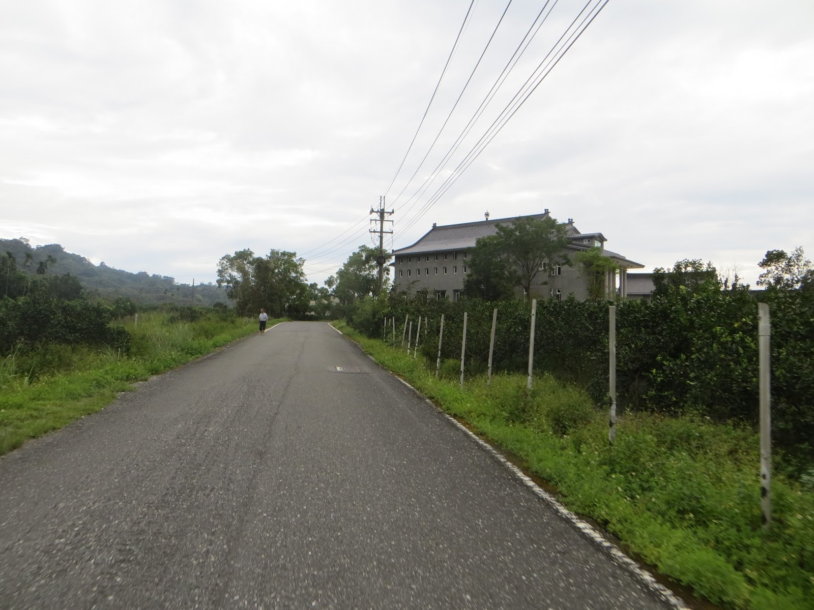
A castle like mansion

Route 193 was slowly counting down


next small town I would pass through: Guangfu. Guangfu is a term that is used by KMT to describe the retro-cession of Taiwan to the ROC in 1945. It means something like honorable restoration.

Slowly the evening was approaching. I had started this 193 in the early afternoon, but that was already a few hours ago

I was really racing for it on the last 20km, even though I was somewhat hungry. My speed was near 40kmph for a long time, and as a consequence of that, I was able to finish 193 before darkness. That was truly nice. I also realized that I would be riding blockbuster numbers on my flatbar. The 200km mark was already long behind me.

With that last section being somewhat moe intensive, I was starting to get weary. I decided that I would spend the night at the end of 193, in whatever hotel I could find.

After several hours of giving it all I had, I made it to the end of 193 before dark. This stage had taken gigantic proportions: Going from Toucheng to Yilan and on to Su'ao, then the entire Su-hua road to Hualien and then the entire Huadong 193. Excellent work!

Incredible achievement today.


Route 193 connected to Hwy 9, which I would have to take south. I first thought that 197 would connect to it straight away, but that was too simplistic. There would first be a part of Hwy 9 as well. I would be repeating some of my 2013 ride.

A map of route 193


Taitung was indicated on the road. That was exactly where I was heading, the next day! I had had enough for today and needed a break. I told myself that I would stay at the first hotel I would find.

I was lucky to find a hostel pretty fast and there were still rooms available. Too bad they did not have Wi-Fi. Another downside was that the only option for food was 711. But that's the price you pay for spending the night far away from the civilized world. I went to that 711 but some sandwiches, salad, drinks etc. I did not go to bed on a hungry stomach. I had a good shower in that motel and then I went to bed.
When I came back from the 711, it was already pitch dark

The moon was visible. A beautiful sight at the end of a beautiful day.

I went to bed as a happy man, I did a crazy 235km on my flatbar and I had made a giant leap on the map of Taiwan. Go check it out and you'll know what I mean. This was most of the eastern coast on one single day. Tremendous! Now let's hit the sack!
No comments:
Post a Comment