Garmin Activity: https://connect.garmin.com/modern/activity/835577684
206km, 7h56, elevation 1478m
I had a good night rest in this hostel in Taimali. I woke up and got ready for action. A quick overview of the map indicated that my goal for the day would be Hualien, about 200km north
The hostel where I stayed, only 350 NT for a night and super good!
One more before hitting the road
The hostel was very close to this intersection. There are three ways of going to Hualien from here: 1) Hwy 9 which I did in 2013 2) Hwy 11 which runs next to the Great Pacific and 3) 197+193 that run between the two. I had never seen the beauty of Hwy 11 so that was my choice for the day. I remember that I was looking for Hwy 11 in 2013 but I never found it, so I took the 9 instead. Today would be a good chance for making up.
The first of many bridges for today...
I noticed that Hwy 11 started counting down from 178. So that would mean that in less than 180km I would be in Hualien city.
Good morning everybody and welcome to stage three of my trip around Taiwan
Riding the flatbar, an excellent choice for this kind of touring: disc brakes, comfy position and beefy tires for more comfort and no shit.
I saw the first 7-11 after a few miles, so I decided to first have my breakfast. Otherwise my sugar levels would not be ok in an hour or so. Best to avoid that...
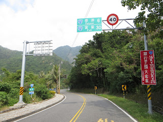
Hualien in 170km. The sun was rising literally in front of me and somewhat blocking my sight. It was even dangerous at intersections. Luckily Taitung traffic is low.

I came past a farm with many tractors. I had to take pictures of these for my family
Mostly Japanese brands

The Fengyuan bridge, a strange name to see. In Taichung were I lived, my best friends lived in Fengyuan. Never thought there would be a second Fengyuan. The only difference is in the written character, which carries three drops of waters. Taichung's Fengyuan does not
Gotta show this to my friends in Fengyuan
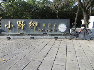
There is a Yeliu in New Taipei city, to the west of Gongliao. Never knew Taitung also had a "little" Yeliu.
Little Yeliu
There was so much to see along this Hwy 11. I stopped to enjoy these views. This was some kind of recreation area, probably for car drivers to relax.
Jialulan, an aboriginal tribe. There are many aboriginal tribes in Taitung county.
That's right, on a sunny morning early on the roads of Taitung, no traffic, just me and this dazzling scenery and landscape. Something inside me just wanted to keep taking pictures everywhere I could. Whatever I could to eternalize this moment.
Many of these aboriginal tribes are of the Christian faith.
Jiamuzih bay
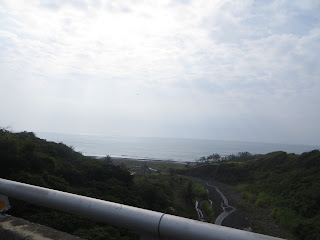
Good morning Taitung and good morning mister Great Pacific. I am honored for being here.
Then I saw something really cool on the signs. In Chinese it said: Water running uphill. I had to take a small detour for it, but I went for it. It was a view of the sea with the optical illusion that the water was running uphill. Made me think of that burning water in Tainan county I visited with my friend Tars in 2012.
Taitung-43, your gateway for water running uphill haha
Details of the water running uphill. I actually left my bike behind to climb up the stairs and go check it out That says a lot if I will get off my bike for it
Obviously this will be unclear on a picture, but this is the spot: water running uphill and tarting all the laws of gravity and Newton.
A castle-like construction in the back
The characters read Dou or du and lan. Dulan happens to be Taiwanese for "angry". Another funny name for a place. Gave me the impression the inhabitants would be extremely cranky haha.
Occasionally, Hwy 11 would pass by a city center, offering me an opportunity for restocking.
And when I saw this I knew the correct pronunciation was Dulan, like mad in Taiwanese.
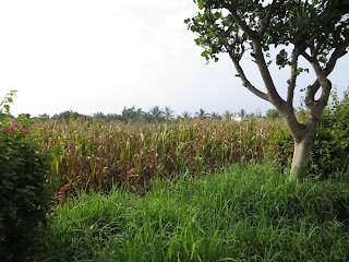
I don't get to see it often, but here we have it: Taiwanese corn.
Enjoying the ride...
Taitung, land of hills and mountains right next to the Great Pacific.
Then i made it to one of the bigger places indicated on my map: Donghe (eastern river)
Progress was good, but this was a touring ride, not a race
Beautiful paradise hidden in the southeast of this island.
I stopped right here to study my map. This Hwy 23 runs between the coastal 11 and the mountainous 9. Over the entire length of Hwy 11 there are only two roads that do this, this one and Hwy 30 way op north. Nathan Miller told me he had ridden this 23 once. I would have to keep it for a later opportunity.
There was a bikeway here. I went to check it out. It was basically a part of road even closer to the coast than Hwy 11. It only lasted a few miles, then it connected back to Hwy 11. I took a movie clip along this path.
The Church of Jesus
I arrived in the next bigger place on the map: Chenggong. Here, I had my lunch. At this time I had completed about 75km.
The section after Chenggong was also breath taking, the combination of a clear blue sky, the summer sun and the views of the Great Pacific. Taitung is truly a beautiful paradise where one can escape the harshness of reality.
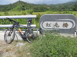
The red hair bridge, in ancient Chinese literature, red hair only referred to one nation and that was the Netherlands, my ancestors. This bridge was here specially for me. I felt honored!
When I took this picture I was thinking: man it is hot! I had an average day temperature of 33 degrees. Take into account that I started early in the morning and that says enough about the temperature here. Must have been around 40 degrees Celsius.
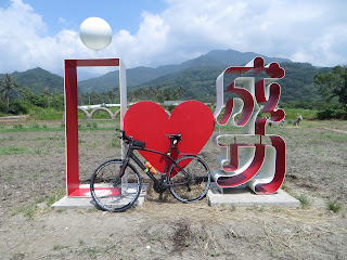
hellahot, but I love Chenggnog
There was a whole section that was calmer, with less houses and basically only sceneries.
I only saw a few other cyclists this entire day.
Isn't this just incredible?
Some minor climbs and descents in Hwy 11. Elevation was almost 50-100 the entire ride. This section was going downhill.
One of the bigger milestones for today's ride: the three digit indication changed into a two digit: 99km
Welcome to Taitung county's Changbin township. Changbin in Chinese means long coast. And yes, the coast was very, very long today.
Later I heard from Nathan Miller that his wife is from Changbin
One of the most special moments all summer long
I stopped in a 7-11 somewhere and I decided it would be convenient to pump up my tire a little. Unfortunately that crappy pump fucked up my inner tire. Luckily I was able to just continue my ride, but I would have to have that fixed in Hualien. I could not do Wuling like that.
Then there was a bicycle path all of the sudden,.I had heard that the government was working on bicycle lanes around the island, but this is where I saw it for the first time.
Huadong bicycle lane 1, counting down from 36 km
This is the summary of my entire ride today: north to Hualien, south to Taitung.
At last, after several hours of cycling, I had finally made it to Hualien county. Usually Wuling is my way to go to Hualien, today it was a little different.
This sign brought me all the way back to geography in elementary school: the tropic of cancer ran through Taiwan and I was approaching its exact location.
Due to the construction works going on I could not come to close
The Chinese name is actually more clear than the western term Tropic of Cancer.

The entrance for Hwy 30, another connection between Hwy 9 and 11.
Current location: Southern Hualien county
Are they actually serious? This is just dangerous!
This was a fantastic stone pillar. In Chinese it reads ren ding sheng tian, people are masters of their own destiny. It is one of many typical Chinese expressions and it was rock solid!
I took a break here, I had already gone over the 100km mark for today.
A bed of flowers at the foot of the mountain
A picture taken from where I just came, at about 121km away from Taitung. That would imply some 50 more to Hualien.
Hualien also has several aboriginal tribes, such as the Amei
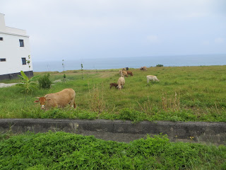
Xinshe, there is also one in Taichung. Funny how many names are duplicated on this tiny island.
The weather was somewhat deteriorating. I saw dark clouds and mist rising in front of me.
And the clear blue sight of the Pacific was getting somewhat more severe.
Jiqi tribe! I once saw a Taiwanese tv show about some Amei kids from Jiqi forming a baseball team. Today I made it to this place, cool!
Then there was a section that went uphill for quite some time. It was a genuine climb.
I started feeling rain drops...
As I was approaching Hualien, it started to rain.
11 km on the Hwy 11, Hualien was drawing nearer. Before I made it to 0 there was a heavy rainfall. I hid it out under a small rooftop. I stood there for some 30 minutes when it finally got better.
This is where Hwy 11 coincided with route 193.
More bicycle lanes

I stopped at a small bike shop to have my tire fixed. Then I saw there was still time to proceed to Xincheng, 20km further north. That would put me in a somewhat better position for tomorrow, when I would climb up to Taiwan's rooftop.
The Hualien airport. Apparently there is one flight per week from Taichung to Hualien. But I don't think the entire operation would be that much faster than just cycling over Wuling.
Hwy 11 stopped in Hualien city. I was now taking Hwy 9 north. I had done this a few times during my Double Wuling rides this year.
There would be more rain coming...
Before making it to Xincheng, there was yet another downpour. This time I got soaked. When I made it to this spot, I did a video report. I had completed 206km, the third 200+ ride in three days. Now there you have some awesome statistics.
I stayed in that hostel where I first went in March, during my first double Wuling ride. Tomorrow's ride would be something else: I would take Hwy 8 to all the way to Wuling, descend to Dayuling again and then continue until Lishan. I could spend the night at the house of a friend of Liao Shi-jie, so that was nice. For today, good job!












No comments:
Post a Comment