Garmin Activity: https://connect.garmin.com/modern/activity/835577779
208km, 8h44, elevation 2142m
It was a cold night in Lishan but I managed. I woke up somewhere around 4:30am and decided to hit the road. Liao Shi-jie's friend was surprised that I wanted to start cycling so early, but I told him I wanted to go all the way to Taipei. When I set food outside it was only about 16-17 degrees Celsius.
Chiang Kai-shek loved to spend his summers in Lishan. That's why he had the central cross island highway built.
The early morning in the central mountain range
The start of a new legendary day
Lishan, part of Taichung
From Lishan I took Hwy 8 to the west, which very soon crossed with Hwy 7-2. That was the main dish for today's meal. That 7-2 would bring me all the way back to Yilan. At this point I was thinking, considering my altitude of 2000m, it is a downhill ride to Yilan.
Beautiful views of the central mountain range, a justification for getting up so early
There was still mist between the mountains and the downhill section was cold. I hadn't warmed up yet. I also thought of what that woman in Shalu told me before: Hwy 7-2 is a very small road, be careful.

Songmao, a tribal village in the central mountain range
Most Taiwanese tribal villages all have a church
The Songmao tribe, also part of Taichung

For the first few km I was loosing altitude indeed., However, considering the fact that there was about 75km 'till the end of this road, I felt I was loosing altitude pretty fast. I had already descended to 1600+, i.e. more than 300m down in only Did not feel right...
I descended until this bridge and then my assumptions were proven correct: after this bridge there would be an uphill part of 10km, with some sections having a steep gradient. I did not understand that there could be suck a long climb when I was supposed to be rolling down to Yilan. The climb was long enough to require me putting out my wind vest.
Rise and shine boy! A day in which I saw a whole other view of Taiwan.
I noticed two things: 1) The Wuling farm was here, I used to think it was where Wuling the mountain is. But the character for ling is different. 2) I was heading for Datong township, when I checked my map, I saw that Datong was Yilan county.
Villages in these valleys... This is truly a non-Chinese side of Taiwan.
Stunning sceneries
Doing to climb up to Wuling and Lishan was definitely worthwhile. This area was so much calmer than Suhua road and it was a real eye-opener.
This area of Taiwan is packed with mountains and tall hills
Whenever I see the lower four characters, my mind starts focusing: would there be another little industry road where new adventures lay hidden? If I ever make it back to this spot, I should go check out this Miao-xi industry road. Who knows where it might lead to...
When I left Lishan, the temp. was about 18 degrees, but that 300m descent in the start brought it down to just 15 C. That was very cold and I needed to wear my jacket.
Looks like a simple forest road? Well I just saw a huge truck coming out of here.
At last the 10km climb was over and I was descending again. I could see on these signs that Wuling Farm was close.
Wuling Farm... Before the 921 quake and before the central cross island hwy collapsed, a lot of tourists would be coming to this farm. Nowadays they all flock to the Qingjing farm on Hwy 14-2.
Nice to be here. I did not have the time to go inside, but at least I dropped by
Welcome to the Wuling Farm.
Taichung-124, I could not see this on my map, because it only had the main roads, but it was something I would have to look up. Where would it lead to? Maybe it's just a small one mad for this farm tourist area. I don't think it would lead into Taichung because that would solve the entire Hwy 8 issue.
After passing Wuling Farm, the descent continued. I had gained some 350m in that 10km climb so there was a lot to descent right now.
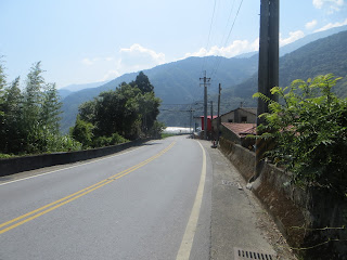
Somehow I entered into more open spaces with wider roads.
A very cute shrine, but somebody needs to mow the lawn here
Police station, probably for those four villages that are here.

It was such a relaxing ride, time did not seem to exist.
Then I saw the triple mount pillar again. This refers to Changhua's Bagua mountain, Miaoli's Xianshan and of course, Taichung's Lishan.
The weather was getting really good. A tad cold in the very early morning but towards the rest of the morning, this were looking fabulous.
Valley in valley
This section was not going downhill, it was even going uphill. Although the gradient was only around 1-2%, the climb did take a few km. Once again i could not comprehend how I could be climbing.
Going slightly uphill had a minor impact on my speed
Another mystery: how could I be back in the Taroko Gorge National Park? I was going south from Lishan towards Yilan. My geographical understanding was tremendously challenged today!
A hiking trail. I saw a few buses parked here. Must have been a hiking group.

The entrance of the hiking trail
Traffic was almost non-existent here, just fabulous
This minor climb was followed by a longer descent, full of twists and turns. I don't remember how many miles it was, but eventually I made it to Datong township in Yilan county. I had now officially left Taichung and I made it to Yilan county. But it was still a long way to Yilan city. During this section I experienced how long this 7-2 was. Once, I was looking at the map and I thought maybe I could do a crazy ride going to Wuling, Dayuling, Lishan and back to Datong like that. Today I learnt that this was not possible in one day. It could not be done.
The next cool thing that happened was reaching the mythical mark of Siyuan Yakou. I had heard several people speaking of it and there is even a race held here every year. Siyuan Yakou was clearly indicated on my map. You could say that from this point, Yilan city was drawing closer.
The sign reads Siyuan Yakou. In the afternoon this place will get thick with mist, making driving a car a true hell
More descents after Siyuan Yakou. The views here were truly remarkable.
Datong township!
Welcome to Datong! There were a few villages here and a few little shops. Perfect for restocking.
These fields, these hills, this was magical!
I could spend days and nights here
Not many people come to this area because it is just too remote. But if I could cycle from Yilan all the way up and then down again, that would be a killer ride as well!
Hey man, put your hands up in the air for fantastic cycling fun
Nanshancun tribe
From this map I learnt that there were a few smaller roads that could offer an alternative to Hwy 7-2. It was not something I had time for today, but that would definitely be interesting for future rides!
Yilan and Taiping mountain were the two major locations indicated on the signs i came across now,
There was a small company trading in tractors here. I took some snapshots to show my family
More downhill, with sometimes a minor climb. The overall trend was roller coaster ride :-)
Lots and lots of agriculture here. They had the room for it.
Nanshan tribe welcomes you. Truly a magnificent setting
Can you see the road inclining downwards?
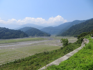
I was standing on the hill and could see farmers working on the plains.
In Lishan everything was packed by mountains. Over here, there were large stretches of plains between the mountains. That's what makes this agricultural activity so interesting
A more flat section, btw don't come here it is raining heavily. Those mountains could get ugly
Another reminder that I was in Yilan's Datong township
Another climb for about one mile. The mileage of this Hwy 7-2 was counting down fast now, this was somewhere around the 26km. Remember I started with 78?
Somewhat more traffic in this village, mostly farmers driving their tractors
A view back
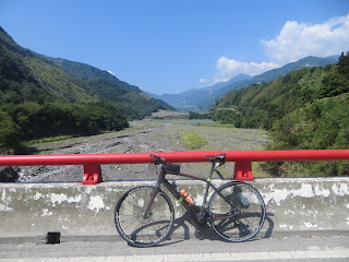
One of the very few bridges of Hwy 7-2
A personal record: 11,000km on this flatbar road bike, in about 7 months time
I just came from this direction
I was examining the possibility of going onto Taiping mountain, if that would be less than 20km off my road.
Aboriginal warriors, you can see them in most tribal villages. Miaoli has quite a lot of these too
Sweet, down to 7km on this road.

Then I saw that it would be 25x2km off my road to do Taiping mountain. That's why I decided I would do it another day. I also checked my map and I saw that Taiping mountain is pretty isolated, far away from this road, far away from Yilan as well, with nothing really close to it.
The Taiping area, Yilan's Daxueshan
I will come back for you! No matter how long it takes!
Qilan
I could see a pattern of today's ride: I was gradually leaving the densely packed mountain range and there were more and more open spaces and smaller hills now.
I made it to the end of Hwy 7-2. I would be taking Hwy 7 to Yilan now.
Where I just came from... If you take a right here, that is the Beiheng (northen cross island highway), that runs from Yilan to Taoyuan. It is another trip I must do once.
Taoyuan? This way please! I heard several friends saying that the section to Taoyuan is quite steep.
I took some pictures here as I wanted to fully understand. Left to Yilan, that's what I had to do.
Upon seeing this sign I checked my map. I could also take this 7-3 to Luodong and go to Yilan that way. However, I sticked to the original plan of doing Hwy 7. It was about 40km to Yilan city.
Songluo tribe, the other one I saw earlier today was Songmao, let's not confuse them :-)
I had descended about 700m now and that had an impact on the temperature
A lot of aboriginal activity in these mountainous areas
The section of Hwy 7 was filled with shorter climbs and descents. The overall tendency was downhill but I was also collecting some nice elevation. At this point my legs felt weary. Nothing strange about that, it was my fifth consecutive day of intense cycling through a lot of mountainous areas.
The closer I drew to Yilan, the further away the hills were.
I also noticed there were a lot of tiny Yilan roads here. I understood right away that this was an area worthy of further research.
The last miles were relatively flat and eventually I made it into Yilan.
Welcome to Yilan! I called Kevin Huang, who had invited me to drop by his DK Cafe. He did not pick up his phone but I did have the address. I asked some locals how to get there and I did find the place. Excellent work!
DK Cafe cycling club, a nice place indeed!

Specialized cycling wear
He was kind enough to offer em a nice meal. I spent a few hours there chatting with him and his coworkers. It was a lovely experience and it would not be the last time I came there. But I still had to continue my ride. I wanted to make it to Taipei city today.
I got some instructions from Kevin. He told me that I could follow 191 or Hwy 9 and I would see Taipei indicated on the map. This blue bridge was a reminder to Yilan's friendship with the US city of Leawood.
Skies were getting dark. I remember myself thinking, are you sure you want to do the entire thing to Taipei? That is still a good 100km through mountain paths...
I passed through Jiaoxi on my way north. Jiaoxi is renowned for its hot spring locations.
When I saw Hwy 9 indicated on the signs, I decided that I wanted to do that one. It would be a unique chance of redoing the Beiyi road I did so many times in 2012.
Jiaoxi hot spring, how can I ever forget?
I recognized this from 2012, Pinglin hwy 9 was where I wanted to head.
Pinglin and Taipei, Hwy 9 please!
That mountain in the back is Xueshan mountain, it is where Beiyi road is located.
This was new: Yilan county Toucheng township
Yilan's cycling network
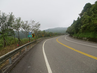
I connected to Hwy 9 and I recognized everything from 2012. The 9 twists and 18 turns were still there. I noticed that my physical shape had improved tremendously. Back in 2012 I was really struggling here. Today, I had my back pack and riding this flatbar I still had an average of 20-21km on this section. That is an incredible speed for a 12km uphill section. Plus remember guys, I started cycling at 5am in Lishan.

This section was returning to my 2012 Taipei life. It was a strange sensation
Climb climb climb to Taipei
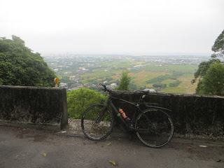
Maybe not clear from the picture because of the fog, but the little Guishan island was still there
This day was gaining the stature of a legendary ride
Beautiful Beiyi Road, how I missed you! Including you in my spin around the island was just right!
I stopped here to do a little video report.
Pinglin, Xindian, Taipei, yes I remember all of these
And then the 12km climb was over, good job!
When I was taking this picture, there was an older Taiwanese couple that started talking to me. We had like a 15km conversation and they were nice. They admired my courage for doing this ride around the island and wished me luck for the remaining part.
What followed was the downhill part. One again, great to be riding disc brakes.
Yueyawan. When I took this picture it started raining
I never went inside, such a shame
There were a few more climbs and descents until I would make it to the mid-way section of Pinglin
What a ride today. I was going beyond my limits.
I stopped at the 7-11 in Pinglin for a quick break. When I checked the map I saw there was a small route called 106-3 that would also lead to Taipei. I confirmed this with the shop worker and she indicated where I had to go. I was in an adventurous mood and I wanted to check this out. It is something I never did back in 2012.
Ready for the next phase of my ride: an adventure towards Taipei
This was it, 106-3 to Shiding. My map indicated I would get to Taipei like this so there were no doubts.
I took a left here and that's where it began. This part was super-steep and I mean several sections of 19%. It stayed that way for quite some time. The first two km were the worst, but it was steep all the way there.
At last the road became more doable. I could see from the mile markers that it was 27km to Taipei city. That was quite a lot.
But the road was tranquil and traffic was low. It wouldn't be Taiwan without an occasional temple like this.
I passed some Buddhist shrines. When I saw this sign I wanted to look at it, I also needed a break. I was sweating seriously from this climbing.
The sun was setting, it would be dark soon. I had been cycling the entire day.
I climbed very intensely and got rewarded by seeing the sign for Shiding. It was downhill from here
I loved the tranquility of this area and the sphere of this setting sun. I felt so free.
The descent was welcome
Taipei was close now
Cycling for a week like I have been doing will result in making stupid faces like this
I somehow landed on Route 106 and arrived at that section where John, All and I cycled together in 2012. Sweet memories!
All of the sudden I was in Taipei city and it was rush hour and it was getting dark. This was the area where the zoo is. I remembered there were cycling lanes here but I did not know how to get there. Luckily there was another cyclists. When i asked him he guided me to the entrance of the cycling lane. That was very kind of him.
Heavy Taipei trsffic
It was dark but at least I made it to the cycling lanes. I called All to see if he was home, but he did not pick up his phone. That's why I cancelled the idea to go to Danshui. Instead I went to the Dadaocheng peer. I called Ke meng-han because he knew a hostel there. He did a good job helping me book that room. That was kind of him.
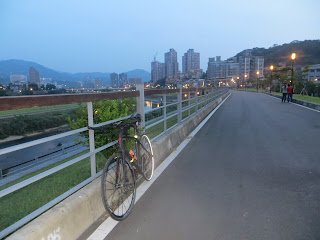
The section from the zoo until Dadaocheng was long enough. I spent some time cycling behind this guy that was going fast. But honestly, there were pedestrians and people without lights, dangerous enough. Eventually I recognized the cycling lanes I took in 2012 for going to my class. I went to the Dadaocheng peer.
Dadaocheng at night. Luckily the hostel was very close to here. I exited from the peer and rode to Shuanglian. To hostel was fine and not too expensive. Thank you Ke-Menghan.
When I arrived at the hotel, I first put my stuff there and then I went outside to have dinner. I went to that girl where Ke Meng-han and I went in September 2014. She told me I lost a lot of weight and that I looked good. Always nice to hear. When i got back in the hostel I took a shwer and fell asleep right away. It was the fourth time in five days that I did more than 200km. It was getting a very crazy ride around Taiwan. If everything would be well, I would be back home in Taichung tomorrow. I want to cycle Hwy 3 in the hills because I still remember the heavy head winds of day 1.














No comments:
Post a Comment