Garmin activity: https://connect.garmin.com/modern/activity/745356943
183km, 8h02, 3002 elevation
My road bike frame had a crack in it and needed to be replaced by Specialized USA. So for today I only had my flatbar road bike to keep me company.I didn't want to go too far but I was in for some nice climbing. Some deep descents would also be nice as I rode a disc brake bike today.
I took the usual ride from Shalu through Taichung to Taiping. From there I started cycling Route 136, but this time I made the little loop for Taichung-99 and Taichung-100. These two little roads provided with a few hundred extra meters of elevation gain.
Along Taichung-99, also known as Beitian Industry Road
Good morning sunshine, let's go for a nice trip even though I only have this flatbar bike at my disposal
Taichung-100, aka Maopu Industry Road
I continued my journey over 136, passing the Chikanding peak and descending to Guoxing again. The picture below is at Chikanding.
Then I took a left on Hwy 14, going east, further into Guoxing
I was cruising over this Hwy 14 and checking out some places I had not looked into before
I really love this Hwy 14, I come here at least once every two weeks. Even done this section a few times in the middle of the night for an early morning climb to Wuling.
Cruising on Hwy 14, flatbar style! This bike is alright though.
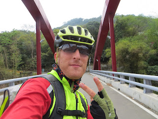
A determined expression, determined to gut some cyclofun today!
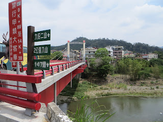
A quick peep to see what was at the other side of this bridge, just a village, nothing special.
View from the other side of the bridge
I had all the time I wanted today, so I stopped to check out this
suspension bridge I had already passed a dozen times. I saw Nathan
Miller doing this before.
After some eleven km of Hwy 14, I arrived at Beishankeng, a village located right between Guoxing and Puli. I first wanted to take a little industry road that would lead to Puli, but due to crappy indications, I could not find it. That's when I suddenly decided that today would be the day that I would check out the 921 Earthquake site.
Taking a right turn for Beishankeng, Route 147
These little green signs are new, I can see improvements, but still a long way to go!
Riding on Route 147, after just 2km, it goes uphill to the 921 Mountain; which was the epicenter of 1999's heavy earthquake
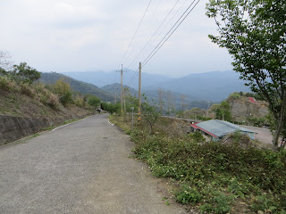
See the small deviation to the right which goes uphill? That is the road I was taking today, up to 921 Mountain. I had heard people telling that this was an incredible steep ascent. They were not wrong, there were sections with a gradient of 19%, the average gradient was above 10% as well, during at least 4km. Still a good workout though!
This is a picture after 3km of climbing. Due to the steepness of this ascent; I did not want to come off the bike and did it in one piece. Pretty nice on this flatbar I must say
National 921 Earthquake memorial site
A map of what is located around here
The Chinese sign says zhenbaodian, which means something like "spot where the earth shook and exploded", by this they mean the epicenter of the earthquake. I went up here and this was another steep climb for 1.5 to 2km, also having gradients of 18% and more.
But before I went there, I checked this out. This little house actually survived the big earthquake, but the ground became so hilly that I lost my equilibrium just standing here.
There was an American with his Taiwanese girlfriend here. They took this picture for me.
Just look at this, damage caused by Mother Nature herself
So after that pinchy second climb I finally made it to the epicenter of 1999's earthquake.
Please take a few moments and analyze this picture: this is soil, earth shaken apart by this earthquake. Mind the trees that are hanging in every direction. Pointless to indicate that this quake had a very impressive magnitude.
This sweat was justified by the incredibly steep climb.
After checking all that out, I could go back, but that's just not who I am. I decided to continue until the road would stop. I wanted to see what else was over here.
Must be a few homes located in this farm road, I was going straight ahead.
I stopped to read this sign, as the characters were rather small and I was shocked by what I saw. The left sign indicated Zhongliao and Nantou. From previous rides and studying the map, I knew exactly where Zhongliao was. However, there was not a road indicated on my detailed central Taiwan map book. I decided to do some research on this when I got back home and maybe even dedicate another trip to this gateway to Western Nantou county; For today I had little time, so I took a right here and checked out what more lay ahead of me.
Suddenly there was I negative gradient, meaning descending. I followed the road for a few KM, but I saw there was still a lot of paved road in front of me. Due to a lack of time, I decided to head back to Beishankeng and Guoxing.
I was obviously standing on one of the higher peaks compared to my neighboring mountains.
I entered Guoxing city center and went back to Taichung via Hwy 21 (Baimaoshan). As usual I visited my friends in Fengyuan for tea. Did some nice discovering today, learning about 921 and seeing with my own eyes how powerful it was.
Guoxing county in Nantou, this time entering from the South via Hwy 14 and Route 133
What a beautiful picture, I could not let this one pass, this cute pink flower bed


No comments:
Post a Comment